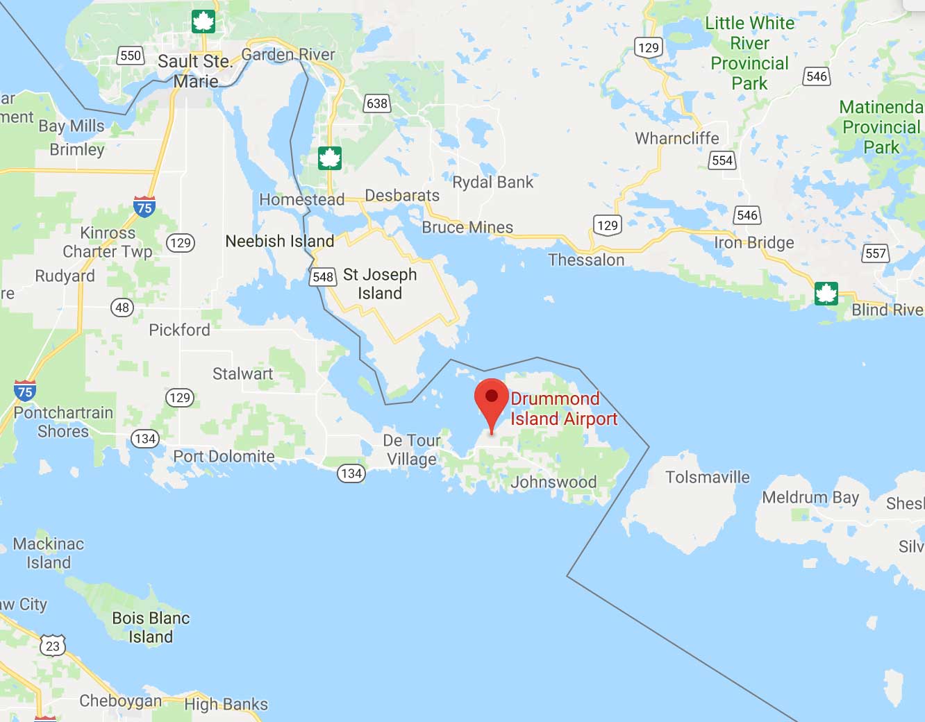
The typical reader would be understandably puzzled by this Homeland Security press release headline: "CBP Permanently Withdrawing Landing Rights from Drummond Island Airport".
What is Customs and Border Protection doing with airport landing rights? Doesn't the Federal Aviation Authority handle such things? And what and where is Drummond Island?
Policy Considerations. Before we answer those questions, let's set the policy context: CBP manages a total of 328 ports of entry, dealing with sea, air, and land arrivals. There is from one (Kansas, for example) to 23 (Texas) in every state. Many of them are in operation 24 hours a day. It is an expensive activity. For an interactive map of the ports see here.
In addition to the full-time operations, there are seasonal and part-time ports of entry, not counted among the 328. There was, for instance, a recent DHS press release about closing one of the seasonal ports in Goat Haunt, Mont., due to forest fires. I challenge the reader to find Goat Haunt on anything but a Google map (hint it is near Canada.)
In most places, the ports deal with substantial flows of traffic, but in some they are there because of local political forces; the mayor, the Chamber of Commerce, and the representatives in Congress all want City X to have an international airport. It means that City X has arrived!
For instance, out in the Commonwealth of the Northern Mariana Islands, just north of Guam, there are, for all practical purposes, only three inhabited islands. There are international airports on all three of them, even though, in the case of two of them, Saipan and Tinian, the two airports are within sight of each other. All three are staffed by CBP.
Just as the nation's foreign student program deals with too many schools (over 7,000 at last report), CBP is stretched too thin over all the full-time and part-time ports of entry. The operation on Drummond Island is one such marginal operation and the government has, totally appropriately, decided to close it down.
Drummond Island's Airport. This field, which has the initials KDRM, is on an island in the northwestern corner of Lake Huron and is about 60 miles east of Sault Ste. Marie, Mich. The island's area is 249 square miles, about 11 times the size of Manhattan, but only 1,047 people live there year-round, with lots more in the summertime. Most of it is a state park. Unless you take your boat or your airplane to the island from the mainland, you have to rely on the once-every-hour ferry.
More to the policy point, there were about 55 international air arrivals per year, presumably from Canada, and for every such arrival CBP had to send an inspector from Sault Ste. Marie by car or in a Border Patrol plane to check on those arriving. The government has decided that it makes sense to close this on-again-off-again facility and require those private flights to land at one of two airports on Michigan's nearby mainland.
While that may be a nuisance to some well-to-do aliens who used to charter flights to Drummond, it certainly makes sense for the rest of us. And, of course, the potential flow of illegal aliens into the United States via charter flights to Drummond cannot be very large.
Drummond Island Trivia. This is not the first time I have written about Drummond Island and CBP, because there is another kind of short-term, port-of-entry activity there each year. When the weather is really, really cold and Lake Huron is frozen solid between Canada and Drummond Island, people use cars and snowmobiles to cross the international border — and hence on weekends during that time of year CBP sets up an ad hoc port of entry at the Drummond Island Yacht Club for the dare-devil drivers. From CBP's point of view, this is far less expensive, one would guess, than servicing the charter flights and, from my point of view, a charming custom to be preserved.
Speaking of maps, as we did earlier, a glance at one shows that, given total rationality, Drummond Island should be in Canada, anyway. The line the splits the Canadian chunk of Lake Huron, from the American part, runs along smoothly in the middle of the Lake until it comes to Drummond; at that point it lurches around the island in a large bump.
According to Wikipedia, the diplomats and mapmakers who drew the line through Lake Huron after the War of 1812, decided (wisely I think), not to draw borders through islands (as was done through both Hispaniola and St. Martin in the Caribbean) and worried about the distribution of Lake Huron's islands between the two countries. So Drummond, all of it, was put on the U.S. side of the line.
Drummond, though part of the United States for about two hundred years, was named for a Canadian hero of the 1812 War, Gordon Drummond, later that nation's governor-general. It was the last part of the United States to be occupied by British troops, which were not withdrawn until 1828.
